Our Software:
Exploring the public health impacts of industrial emissions and decarbonization
LOCAETA integrates air quality data, air dispersion models, demographic and environmental justice considerations, and potential health benefits associated with decarbonization pathways to characterize the health and economic consequences of adopting clean energy technologies, such as industrial electrification, carbon capture, and more.
We developed LOCAETA to empower community members, planners, and investors to consider the potential emissions, air quality, and health consequences of decarbonization technologies.
State and federal governments, NGOs and community members, clean energy investment companies, and the commercial decarbonization industry.
Our Process
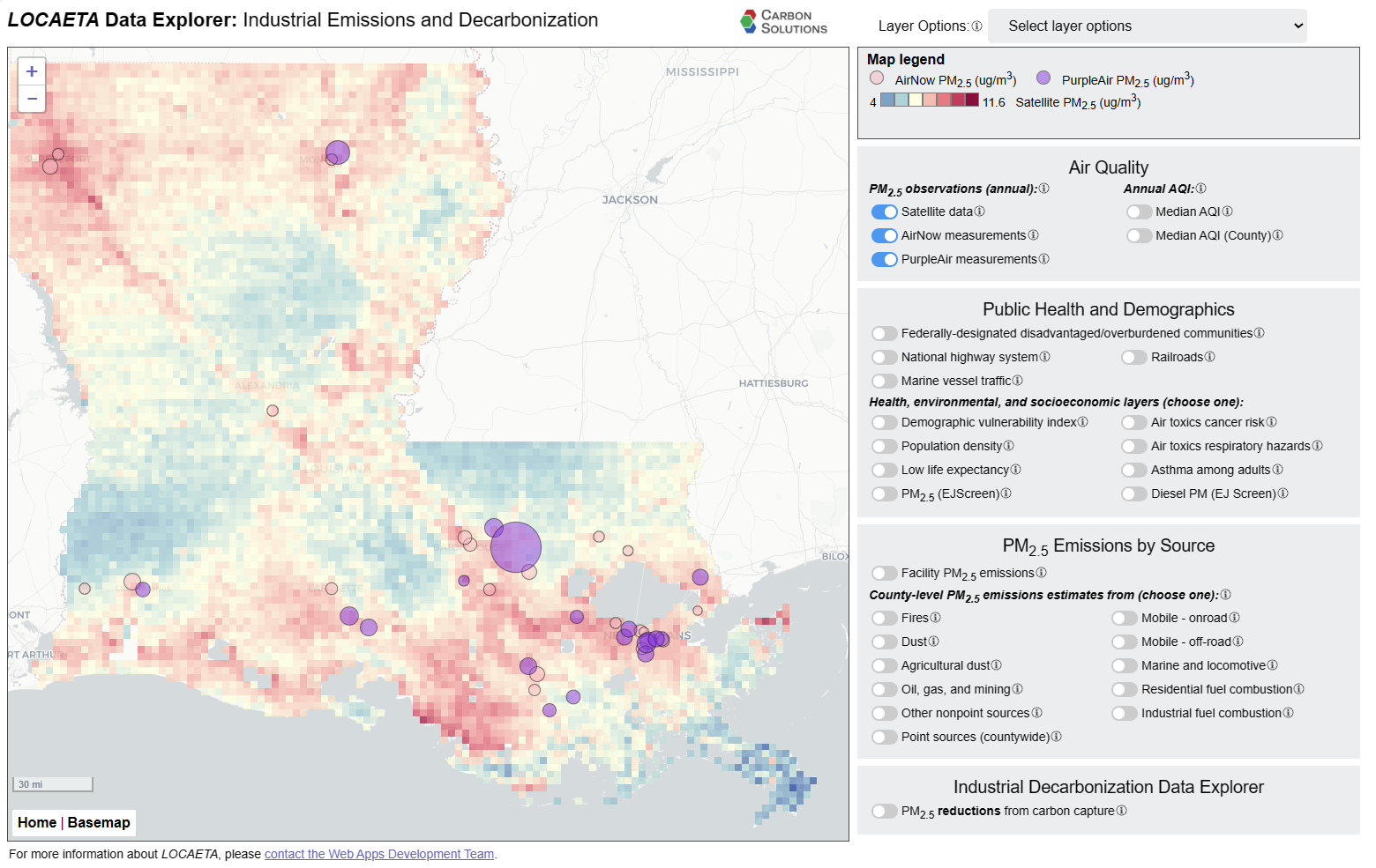
LOCAETA is a modeling and analysis platform that includes air dispersion modeling, facility emissions and air quality data, population exposure, and health risk models to assess the public health impacts of emissions. Results and other relevant data layers are displayed in an interactive, easy-to-use Data Explorer web interface.
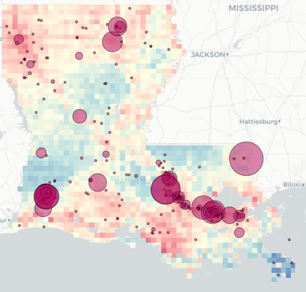
LOCAETA uses a range of data products, such as satellite and in situ air quality data, to assess the impacts to communities from air pollution produced by specific emitting facilities.
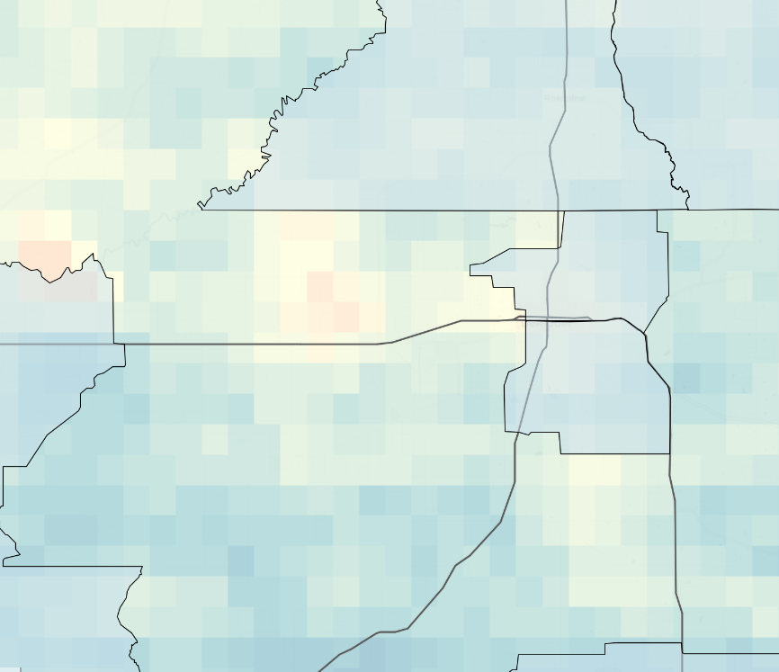
Using physics-based models, statistical analysis and machine learning, LOCAETA generates results that predict how air pollution from industrial facilities would change under different scenarios involving decarbonization.
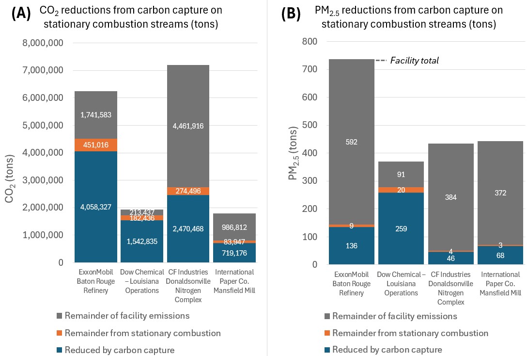
Our software integrates air quality data, air dispersion models, and health impact modeling to demonstrate trade-offs and co-benefits of a range of potential technology pathways to decarbonization, such as electrification, carbon capture, hydrogen fuel-switching, and more.
A nationwide, screening-level version of LOCAETA will be released by early 2026 with additional pollutants, decarbonization technologies, and public health benefits results. In the meantime, focused local projects using the platform are underway to support clean energy planning in specific geographic areas. Please contact us if you would like to discuss a local LOCAETA project to evaluate, quantify, and visualize the public health impacts of industrial facility emissions and potential decarbonization co-benefits.
Learn more about LOCAETA and how it can benefit your organization.
Our Team

Research Scientist
Amy is a hydrologist with professional experience in astrophysical, planetary, and earth sciences with a focus on numerical modeling of complex systems.
She provides expertise on air quality co-benefits to decarbonization, groundwater remediation, nuclear waste repository performance, geologic carbon sequestration, and nuclear nonproliferation.

Research Scientist
Kelly has experience using global atmospheric chemistry models, along with satellite and in situ data, to understand carbon dioxide exchange in the Arctic Ocean.
She focuses on atmospheric science and modeling projects, integrating modeling, data science, and atmospheric chemistry.

Research Scientist
Yunha is a computational scientist with experience in developing atmospheric models for air quality and climate applications, both physics and machine learning approaches.
She focuses on the socioeconomic impact assessments of low-carbon energy technology.

Research Scientist
Veronica has a multidisciplinary background spanning business and the energy sector, with a proven ability to unite diverse stakeholder groups and drive collaboration.
She provides project support and helps build strategic partnerships that advance organizational objectives and create lasting, positive impacts on community development.

Director of Engagement
Jessi has a multidisciplinary background in environmental sciences, policy, management, and urban and regional planning.
She supports the deployment of decarbonization technologies through an understanding of local community opportunities and impacts.
Information Hub
Learn more about the LOCAETA projects we have completed.

Carbon Solutions has been instrumental in the development of our sequestration project in Wyoming over the last 2.5 years. They continue to deliver a work product that exceeds industry standards. I value our relationship and will ensure Carbon Solutions is embedded in the development of our project as we grow.
Jess Foshe
President & CEO
